Lewis and Clark Cycling Trek

Saturday, July 23, 2005

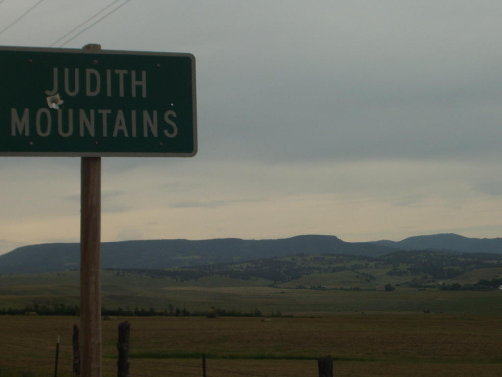
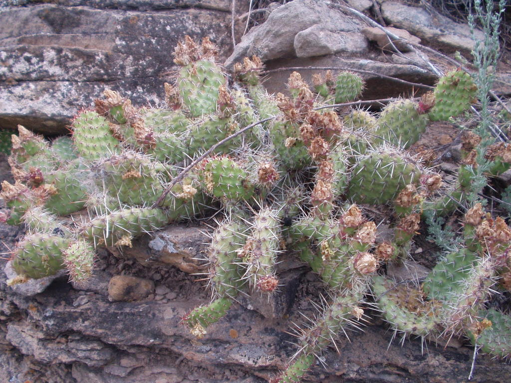
Cactus in the Judith Mountains

Judith Mountains just before rain

Approaching the Judith Mountains

Hayfield near Winnett, MT

Hill Ranch Oasis Bed and Breakfast

Wild cottontail rabbit resting in the shade.

Shoeing Horses in Winnett, MT

Conclusion and Seventh Grade Questions

As you may have noted, this is the conclusion of our trip. We are not home yet. We still have a 44 hour bus ride to get to Warsaw, but the bicycling portion is over for this year. We are already planning our 2006 leg of the journey...stay tuned.

It's time to find out the winner of the prize! Send all of the information to lewisclark.2005@gmail.com before August 1st. On a Word document, please include your name, the date of the question, a brief description of the question, and the answer(s). Attach this document to the email. If Microsoft Word is not available, this information can be directly copied and pasted into the email. On all answers, be as specific as possible. This may be used for tiebreakers if necessary. SpokeWrench will look at the answers and grade them. The winner will be announced on a blog soon after the entry deadline. The answers to all of the questions will also be given. The winner will be notified about instructions on receiving the prize. If anyone has any questions about the wording of the questions (before the deadline), they can be sent to the email address above. Of course, the answers to the questions will not be given.

Since we have done all the biking we will do for this leg of the trek, SpokeWrench has compiled about every stat we have on record of the trip: (We don't expect you to find them interesting)

SpokeWrench-ClarkWheel

Highest Speed: 37.8 mph- 38.9 mph

Lowest Speed: 1.9 mph- 2.5 mph

Highest Average Speed: 14.0 mph- 12.9 mph

Lowest Average Speed: 7.1 mph- 7.5 mph

Flat Tires: 2- 4

Longest Day: 98.38 mi.

Shortest Day: 20.87 mi.

Longest Ride Time: 15.5 hours

Shortest Ride Time: 5 hours

Longest Uphill: 46 mi.

Longest Downhill: 9 mi.

Other Bicycle Tourists Met: 6

Total Trip Length (Days): 40 days

Total Trip Distance (2005): 1680.98 mi.

Total Trip Distance (2004 + 2005): 2087 mi.

Thanks for following along with us!!


-SpokeWrench and ClarkWheel

Winnett, MT to Lewistown, MT- Day 39- 58.63 mi.

I know I've said this before, but what a difference the wind makes from one day to the next. Today, the wind was light out of the east and that is to our backs!! We left Winnett at about 8:15 filled with a good breakfast from the Kozy Korner. The first half of the ride was pretty much flat. We stopped at about 11:00 at Grass Range at a truckstop/restaurant/campground for lunch. After Grass Range the road started heading in an upward direction. We were approaching the first mountains of the ride. This range was called the Judith Mountains and is a part of the foothills of the Rocky Mountains to come. With the lack of a headwind, even climbing didn't seem so bad. This range was steep enough that the transportation department had a pulloff at the start of the Judith Mountains for vehicles to put on tire chains in the winter and another place to take them off on the other side. Even though mountains mean some hard pedaling, it was a pleasant change of scenery. We saw large pines on the hillsides and cooler temperatures as we ascended. We summited at about 4800 feet. This was followed by a 9 mile downhill of 20-30 mph into Lewistown. We secured a campsite at the Mountain Acres RV Park and then thought it might be a good idea to start figuring out how we are going to get home. I called the car rental place in Lewistown...no one way rentals outside of Montana. I called the Avis rental in Great Falls...no vehicles available. I called the Avis rental in Billings, thinking I could rent a local one way here in Lewistown to Billings and then rent another vehicle home. This would have worked except for one small detail. There is a $750 fee for a one way rental on top of the car rental fee. This brought the grand total to well over $1000 plus gasoline and the rental fee to Billings. We still didn't have an SUV, it was just a sedan. At this point we decided that we would try to head back home from here in Lewistown instead of going on the Great Falls. The weather did not look good for the next 3 days, with headwinds in the forecast each day. So back to the drawing board...no trains out of Lewistown, but there was Greyhound bus service. We biked down to the bus depot and talked to them. For slightly over $300 we could get a bus home with our bikes and trailers as long as the bikes were boxed. Boxing the bikes was the only hitch in this plan, but there was a bike shop in town and most shops will box bikes. The shop was closed by this time so I called and left a message. Next morning, Mark from High Plains Bike and Sky Shop called me and said no problem boxing our bikes and he would even drive them down to the bus depot. It looks like we are set to come home.
Seventh Grade Question:
This entire trip was brought on by a story I read when I was a fifth grader at Leesburg Elementary School. It was a story about how Lewis and Clark came to a fork in the Missouri River and didn't know which way to go. It was called, "Which is the Missouri?" Since reading that story, I have dreamed of someday following the Lewis and Clark Trail. We are fairly close to that fork in the Missouri. What is the present-day name of the river that Lewis and Clark nearly mistook for the Missouri?

-ClarkWheel

Thursday, July 21, 2005

Mosby, MT to Winnett, MT- Day 38- 27.67 mi.

Notice the short mileage today...the wind defeated us. It totally demoralized both of us. We had planned to try to make it to a small town called Grass Range today, about 55 miles from the Hill Ranch Oasis Bed and Breakfast. Speaking of which, we enjoyed an excellent breakfast with interesting conversation with the Hills this morning. We packed up and were on our way by 7:30...early start...no wind...right? Wrong!! The wind had already picked up straight out of the northwest at about 20-25 mph, our direction of travel for the entire day. We noticed right off that we were making a whopping 5 mph average in the first hour and the wind was picking up even more. The closest refuge from the wind is this town, Winnett, MT. We pushed our way for 5 hours against the wind. It seemed like we were getting nowhere, just like Lewis and Clark mentioned when they hit those windy days. We finally arrived at Winnett, biked to the Kozy Korner Cafe hungry and tired. After a relatively short discussion, we decided to stay here for the night and not try to move on another 24 miles. We checked out the city park, but it didn't look too conducive to camping. We read about an inexpensive bed and breakfast in the area and we inquired, but it was 12 miles back to the east where we had just biked. Neither of us felt like biking back half the distance we struggled through this morning, so we checked out the only motel in town. It was open, looked pretty inviting, and the price was right. We secured the room for the night. I am writing this blog from the town library which also serves as the school library for the K-12, 100 pupil school. It is a very nice community library for a town with a population of only 158...Leesburg, take notice...small towns can have a library! Later I visited the Trading Post and Ice Cream Shop, run by the 5th and 6th grade teacher here. We had a nice chat and I had a delicious Raspberry Moose Tracks shake. SpokeWrench went for the more traditional (and boring) chocolate shake. Too bad Lewis and Clark didn't have that shop when they passed through. We will soon be passing by where the Judith River joins the Missouri and that brings us to....
The Seventh Grade Question:
How did the Judith River get its name?

-ClarkWheel

Wednesday, July 20, 2005

Jordan, MT to Mosby, MT- Day 37- 51.12 miles

We were up and packed by 7:00 and went up to the nearby cafe for a big breakfast before heading out. Strangely, neither of us could finish our breakfasts today. Usually we are famished. We doggy-bagged what we could and headed down the road. We made excellent time today even though the terrain remained fairly hilly. The hills today seemed less steep, but perhaps longer than the journey from Fort Peck. At the 31 mile mark we came across the town of Sand Springs, population of 1, the owner of a country store. The store was also the post office for this tiny town. The store had a surprising amount of goods and we were able to have our lunch and hydrate before heading on. Before we left, the post mistress suggested a bed and breakfast for tonight about 20 more miles down the road, but she warned us that it was a hilly 20 miles. I (ClarkWheel) saw a sparkle in the eyes of SpokeWrench when she mentioned a "Bed and Breakfast." I called ahead and found the accommodations to be quite reasonable. The only problem was that it was a mile off route, on a gravel road, and there was a big hill to climb to get there. We decided to bike to the entrance and take a look, making a final decision at that point. It didn't take too long to make it to the entrance road with the nice tailwind we had today. We were there by 2:30, a little early in the day to stop, but we had already covered 50 miles...not a bad day for us. There was a sizeable hill to conquer to get to the bed and breakfast, but SpokeWrench was adamant, "Let's go for it!"
We did just that and did have to walk our bikes up part of the hill. Pulling the trailers on gravel just didn't give us the traction and our tires would keep spinning out. We did make it, of course, and were treated to the site of the lovely home, the Hill Ranch Oasis Bed and Breakfast of Phil and Delores Hill.
The terrain in this area is the same, but we are seeing something new. Soon after leaving Sand Springs, we began to see pine trees on the tops of some of the hills. By the time we arrived at Hill Ranch Oasis Bed and Breakfast, there were many pine trees and scrub pines. Enough that we could smell the fresh pine scent as we biked. I don't know what the difference is, as the hills appear about the same. The area between Jordan and Mosby was also significant for Lewis and Clark. It was in this area that Sakakawea's husband carelessly swamped a dugout canoe that was carrying Lewis and Clark's most prized possessions. Sakakawea wisely recovered all of their possessions before they would have been lost in the river. This brings us to...
The Seventh Grade Question:
Name one or more of the items that Sakakawea recovered.

-ClarkWheel

Fort Peck, MT to Jordan, MT- Day 35-36- 98.38 mi.

Nearly 100 miles of nothing! From Fort Peck to Jordan, the only thing we saw the whole day that suggested any sign of civilization was a small rest area at about the 62 mile marker. The night before, we had prepared for the next day by trying to get a very early start. Our original plan was to leave at sunrise, about 5:00. This plan left us without breakfast, as the hotel's restaurant didn't open until 7:00. The manager of the hotel told us that there was a convenience store near the Fort Peck Dam that opened at 6:00. So, we set our departure time back to 6:00 and slept in for a while longer. After leaving the hotel, anxious for food, we biked to, over, and past the dam without seeing a convenience store. We were both disappointed because not only did this mean we would miss breakfast, but we would also have to take the time to cook along the way. At about the 43rd mile, we stopped and cooked a freeze dried meal. After that, we kept biking our hilly route until we came to a blessing... a rest stop! There were bathrooms as well as a place to fill up with cold water. We took this opportunity to cook a bit more food and get re-energized. With only 36 miles to go, we tried to bike quickly to beat darkness. Our maps give us a profile of how hilly the terrain is from place to place, and the route looked very flat. We thought we could average a high speed and get to the campground before dark. Well, the maps were wrong. The route was very hilly, and it took us a long time to get to Jordan. When we did get to Jordan, the moon was shining brightly, and the "Garfield Motel" shone even brighter. Not wanting to set up the tent in the dark, we settled on the motel for the night at about 10:00. After eating a pizza for a late supper at 11:00, we went to bed very tired. We had completed a day less than 2 miles short of 100. Lewis and Clark mentioned having very difficult, tiring days on their journey, and this was one of ours. When we woke up in the morning, we were both still very tired. We decided to take a rest day. During the day, we changed to Kamp Katie, bought groceries, updated blogs at the local library, and had delicious smoothies at a coffee shop.
Seventh Grade Question: We biked a total of 98.38 miles today in 15.5 hours. What was our (pathetic) average speed?

- SpokeWrench

Not everything was bad on this long, long day. We saw a number of deer and antelope. We saw some antelope up close for the first time. One was bedded down next to the road. The cars apparently didn't bother it, but the bicycles spooked it out. As we were biking to Jordan around dusk, I looked to my left and saw a lone antelope standing on a ridge. It was silhouetted against a full moon. I would have loved to put this image on the blog for you, but it was too dark for my camera...I do have it stored in my mind though!

-ClarkWheel

Tuesday, July 19, 2005


Seventh Grade Question for Day 33

Entering the 670 mile length of Montana


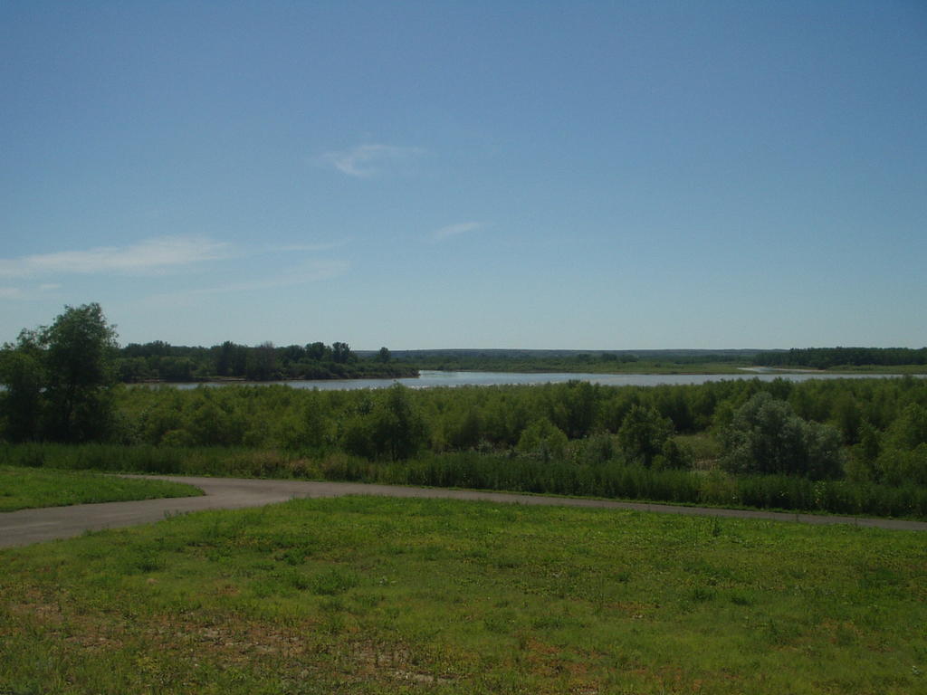
The Confluence of the Missouri River and the ???? River


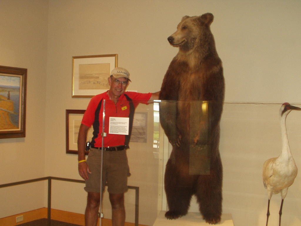
A Grizzly Bear at the Confluence Interperative Center

Wolf Point, MT to Fort Peck, MT- Day 34- 52.34 mi.

My fears were confirmed! The wind that started the evening before had not let up by morning, in fact it had gotten stronger. It was whistling by at 30 mph rate with gusts from 40-45 mph. It had also rained most of the night and when the alarm rang at 5:15, it was still raining fairly steadily. We did not want to pack up in the rain...at least that was the excuse we told each other so we could rollover and sleep another 2 hours. When we finally did get up around 7:30, we questioned whether we should try it or not as most of the route was directly northwest into that wind. We finally decided to try it. It was unbelievably difficult. In my opinion, it was one of the hardest days yet. Coincidentally, Lewis and Clark had wind problems in this same area when they passed through in their boats going upriver. It completely stopped them for a 2 or 3 days in a row. Unlike Lewis and Clark (who may have had better sense) we pushed our way through that wind for about 11 hours before arriving at dusk at Fort Peck. Not wishing to set up a campsite in our exhausted state, we stopped at the Fort Peck Hotel. This was a historic hotel with 2 stories and wooden floors. It had a restaurant buffet which we enjoyed and gave us a good night's sleep before attempting our longest stage yet..the 96 mile voyage to Jordan the next day. The manager of the hotel promised me the coffee would be ready at 5:00 a.m. and that we should go right on into the kitchen and help ourselves. He said he would also put out 2 caramel rolls for us to eat in the morning before leaving.
Seventh Grade Question:
What was the name of the only African American that accompanied Lewis and Clark to the Pacific and back?

-ClarkWheel

Culbertson, MT to Wolf Point, MT- Day 33- 60.48 mi.

Wolf Point, MT is on the southern edge of the Fort Peck Indian Reservation as is all the small towns we have passed through today. As we bike through Indian Reservation territory, we see very few permanent homes. Mr. Gilbertson, of the Deep Water Bay Bed and Breakfast, explained this to me when we were there. He said that since the tribal land cannot be bought or sold, banks will not loan money for building homes because the potential homeowner does not own the land....kind of a strange "Catch 22". If we see dwellings, they are most often mobile homes. We met a British gentleman on our route today. He is biking the Northern Tier Transcontinental Trail with an ultimate goal of Halifax, Nova Scotia. We set up camp at the Rancho RV Park just outside of Wolf Point. Wolf Point is a fairly large town in the reservation. In the evening, we were surprized by a sudden shift and huge increase in the wind. The speed jumped to nearly 40 mph and was coming from the northwest rather than the southeast as it had done all day. By 9:00 p.m. it had begun to rain and the wind continued. If it continues all night into tomorrow, we could be in for a difficult day against that northwest wind.
Seventh Grade Question:
In the picture labeled "Seventh Grade Question-Day 33, what is the purpose of the machine. SpokeWrench calls it a giant toothpick dispenser. Hint: It is not a toothpick dispenser!

-ClarkWheel

Williston, ND to Culbertson, MT-Day 32- 62.46 mi.

Let's start out with a question today that highlights our activities.
Seventh Grade Question: Just outside of Williston, ND one can find the confluence of the Missouri River and what other important river? On Lewis and Clark's return trip, they took different routes with Lewis exploring this river.
We left the motel early this morning and biked to Trenton, ND to a quaint country store that had all the ranch's brands on wood around the perimeter of the store. We had a snack there and bought a few groceries. From there we biked on to the Confluence Interpretive Center near Trenton, ND. This is the spot referred to in the seventh grade question. It was an interesting center. In one display, we took some pictures of us standing next to a stuffed grizzle bear. At Lewis and Clark's time, grizzles were living in this area. The corp soon found that they great bear was a force to be reckoned with. They found that just one shot was not sufficient to down this bear. Sometimes it would take 8 or 10 shots to bring one down. After the first encounter or two, the men were willing to leave well-enough alone. We also visited a reconstructed fort, Fort Buford, where the great Hunkpapa chief, Sitting Bull, surrendered. The fort had many very interesting artifacts that was brought to our attention by the guided tour we were able to take.
We biked on into Montana today and spent the night in the town of Culbertson, MT. Our campground was in the city park. We have nice grounds, electricity, restrooms, but no showers and all for free. It was really very nice. Culbertson had just had a damaging storm two days before. They had many trees down, roofs blown off, and one house was destroyed. It was not a tornado, but rather 107 mph straight winds that did the damage. No storms tonight for us. It was cool with a gentle breeze all night.

Thursday, July 14, 2005

Williston, ND about 5 miles in the distance

Bluffs on the way to Lund's Resort

Lund's Resort to Williston, ND- Day 31- 25.87 mi.

Big storms last night...fairly heavy rain, constant thunder and lightning, and some wind. The tent held up pretty well. Tai's side did draw up some water through the bottom of the tent. He may have been in a low spot. We were packed and ready for Lund's Restaurant to open at 7:00. We had a great breakfast at Lund's. I had Juneberry pancakes and they were delicious.
Lewis and Clark were also in this area according to the Lunds. On their return trip from the Pacific, Captain Lewis, dressed in buckskins, and one of his men were elk hunting near the present-day location of Lund's. The man hunting with Lewis mistook him for an elk and shot him in the derriere. According to the journals, Lewis was fine but very sore for a few days.
We left at about 8:15 toward Williston and into nearly one hour of uphill pedaling. What a way to wake up! There were several other challenging hills in our short ride today. It was short because we had many errands to do in Williston before heading into Montana tomorrow. I have completely worn out my biking gloves. They just fell apart. I found a new pair at the small bicycle shop in Williston. It is also laundry day and we have these last three blogs to upload. I hope to do a little grocery shopping before leaving as well.
Seventh Grade Question:
We will leave North Dakota tomorrow. We have met many kind and helpful people...after all, the word "dakota" in the Sioux language means what?

-ClarkWheel

P.S. We have decided on a probable destination point for our trip. We think we will stop at Great Falls, Montana; about 525 miles further on. It is possible we may not find an internet connection between here (Williston) and Great Falls. Larger cities are few and far between. Of course, if we find a connection, we will be sure to upload the journals. Of course, we will bring it all up-to-date in Great Falls.

New Town, ND to Lund's Resort- Day 30- 52.34 mi.

You'd better believe we made a hasty retreat from the mosquito infested campsite at the New Town Marina and Recreation Area. We biked back to New Town on a bicycle-only trail that parallels route 23. We rode to the breakfast cafe in town. While we were eating, an older gentleman approached and asked where we were biking. We told him our plans and he seemed interested that we were biking the Lewis and Clark Trail. He told us that recently he had spoken to a large group of teachers about Lewis and Clark. He seemed to be somewhat of an expert so I asked him about the mystery surrounding the death of Sakakawea. (Some say she died at the age of 25 and others claim she lived to be 80. The location of her remains is a mystery as well). This gentleman turned out to be a Hidatsa Native American that had a connection to Sakakawea, so I asked him what his feeling was about her. He told us a very interesting story. He said that in 1955, he asked his 80 year-old grandmother about Sakakawea. He told us that his grandmother told him that Sakakawea was not the Native American the history books contend...
Seventh Graders: What Native American tribe do the historical accounts say that Sakakawea originally was?
...His grandmother told him that Sakakawea was a Hidatsa, not as history recorded and furthermore, their family was related to Sakakawea. According to this story, Sakakawea died at the age of 80 in this very area around New Town. This man's name was Esley Fox Thorton, a very interesting man with an interesting story.
We left New Town and biked into some of the largest and longest hills encountered so far. We kicked around the idea of biking on to Williston, a ride of 75 miles, but the hills wore us down, not to mention the temperature was 100 degrees. We decided to stop at Lund's Resort. I called ahead and I got a recording that they were closed for the day. Bad news...but there was another campground nearby so we continue on. We stopped at the other, 3D Campground, but it was out-of-business. We went on to Lund's. This was a very nice campground with a restaurant, but closed for the day. There were two other bikers looking for campground as well, Amanda and Mary, college students riding eastbound across the U.S. We talked it over with each other and a couple of fisherman staying in a cabin and decided to go ahead and set up camp and pay in the morning. We talked for quite a while with the girls and enjoyed comparing notes with them. This campsite had many fewer mosquitoes (until dusk) and much better water.

Deep Water Bay Bed and Breakfast to New Town, ND- Day 29- 44.51 mi.

We were treated to a great rancher's breakfast at the Gilbertson's bed and breakfast. After pancakes and sausage and all the extras, we tried our internet connection, as we had been unsuccessful the night before. This morning everything was working, so we updated everything and then prepared to leave for New Town. New Town is the area that Lewis and Clark figured was the furthest any white man had ventured west. From this point on Lewis and Clark had only the sketchy information about what lay beyond from the Native Americans in the area. It must have made them think twice about what they were doing. We, however, knew exactly where we are going and traveled today uneventfully. The ride was normal with some fairly challenging hills in the second half of the trip. In New Town, we camped at the New Town Marina and Recreation Area. It seemed like a rather primitive campground. We were assigned a campsite that looked pretty enough, surrounded by a small wooded area, but when we pulled in and dismounted, millions of mosquitoes descended on us. It was unbelieveable! DEET was absolutely essential all evening and then it was nearly unbearable. In addition, the manager advised us not to drink the water, it was brown. We bought a gallon of water at the small convenience store. At the campground, we met up with a transcontinental traveler headed east. Byron was interesting to talk to and we compared notes on best traveling methods. After cooking supper and eating, we took showers in the brown water, played a couple of hands of gin rummy and a couple of games of tetherball (away from our campsite), and headed for the tent. There just wasn't much else we could do. I woke up several times during the night to see our mosquito netting lined with mosquitoes just waiting for one of us to as much as stick our heads out of the tent...rather unnerving.
Seventh Grade Question: Much of the land around New Town is part of the Fort Berthold Indian Reservation; the home of what three Native American tribes?

-ClarkWheel

Tuesday, July 12, 2005

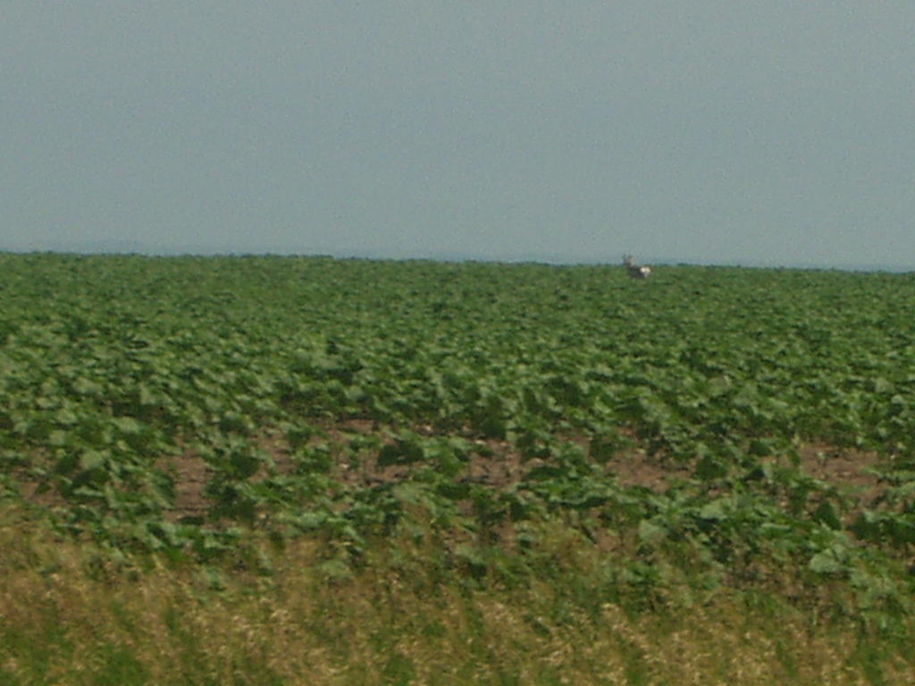
A pronghorn antelope on the trail.


A prairie dog at Fort Stevenson State Park


Tai's new form of mosquito repellent.


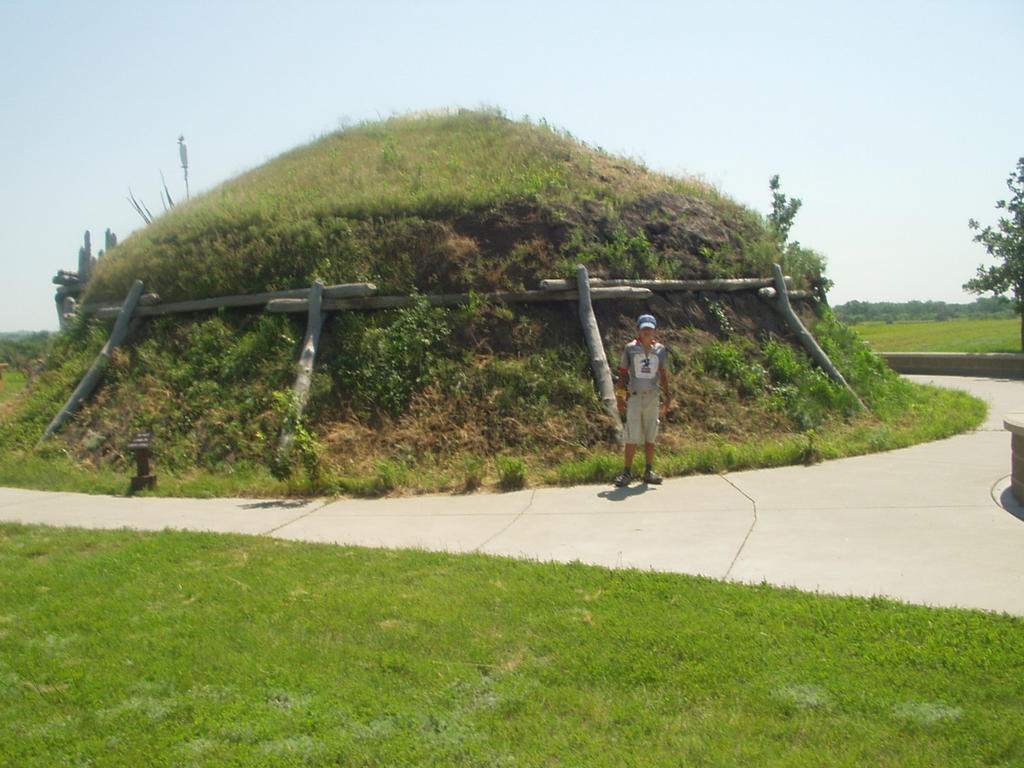
The earthlodge at Knife River Indian Villages in Stanton, ND


Fort Stevenson State Park to Deepwater Bay Bed and Breakfast- Day 28- 44.46 mi.

Lewis and Clark often wrote about how they were plagued by mosquitoes. We really never understood fully what they were talking about until Fort Stevenson Campground. After last evening and this morning, we have some idea. The mosquitoes were ferocious. Just at dusk, they literally drove us into to the cabin for our traditional Lewis and Clark gin rummy game. This morning, just to get our dried clothes off the line and use the restroom, DEET was essential. They were attacking in full force and it was impossible to keep them off. We left the campground and those aggressive mosquitoes at 8:45 after a breakfast (cooked inside the cabin). It was fairly hilly route today...and a windy one. The wind was either quartering into us or a full headwind all day long. The wind was around 15 mph, strong enough to impede our travel somewhat. We biked though the Fort Berthold Indian Reservation and had lunch at Ree's Store, I believe on the reservation. While there, we called a bed and breakfast about 20 miles further west and north. Yes, they had rooms, campers, or tent sites at varying prices. When we arrived around 4:00, we found internet service in the house, so we took one of the rooms in the house. The people here are very kind and helpful. I was able to do laundry, cook on a stove in their garage and we will be treated to a rancher's breakfast tomorrow morning. This is wonderful place to stay. Mrs. Gilbertson asked us if we would like to go for a drive and see the tipi rings that are still visible in some area near here. We agreed immediately and she took us in her Suburban though the fields to high point on their property. There before us were rings of stones that once circled the tipis of a former Native American culture. As I looked around, I could see that this location was chosen for a specific reason. From this vantage point, it would be impossible for an enemy to sneak up on the tipi dweller. I could see for miles in all directions.

Seventh Grade question:

Many of the Indians in this area built earthen lodges for their living quarters, yet we often see tipis standing on the reservations. Why did the Native Americans sometimes use tipis rather than their earthen lodges?

-Clarkwheel

Pick City, ND to Garrison, ND- Day 27- 44.13 mi.

As you can see from the title of today’s blog, we biked over 40 miles, but the interesting thing is that our campsite is within 2 or 3 miles of the campground last night. In order to continue our route north, we had to bike around Lake Sakakawea. This is a very large lake created by the damming of the Missouri River at Garrison Dam. Getting from the south shore to the north short required the 40+ mile ride. We had hoped to get an early start because NOAA Weather Radio said that the wind would switch in the afternoon and come from the northwest, creating a headwind for us. It turns out that the wind switched early and by the time we are up and going, it had already switched. We ended up biking against the wind most of the day…but it was cooler. We had in the back of our minds a possible 65 mile day to Indian Hills Resort. That thought was quickly put to rest by the constant headwind. We didn’t make very good time. We did have some interesting sights, though. We biked across one of the largest earthen dams in the world and the 5th largest dam of any kind in the U.S.A. We also saw our first antelope today. There were a pair of them along the road, but they quickly moved out of the camera range. SpokeWrench did get a couple of pictures on the antelope before they disappeared in a cornfield. Today I notice a large cultivated field that had a crop that was blooming the most gorgeous blue flowers. The field looked like a large blue lake. At the lunch diner in Coleharbor, we asked about those beautiful blue flowers and was told that it was flax. They are really very beautiful. We stayed in a primitive cabin this night. NOAA Weather Radio had predicted the possible of severe weather for tonight and I felt it would be better to have something a bit more substantial. The cabins were reasonable and quite nice. It was a good decision. We biked over to a prairie dog town that the parks department was protecting. Tai was able to get a good photo of the prairie dog barking at him.

Seventh Grade Question:

What is the only mammal that can run faster than a prong-horned antelope?

-ClarkWheel

Washburn, ND to Pick City, North Dakota- Day 26- 47.64 mi.

For an instant, it is 250 years ago, I am standing in a Native American earth lodge. I am in the exact center. I stand in wonder, looking around at the 18 member family that lives there and their possessions. Just as quickly, I am still standing in the exact center of the same 40 foot Native American lodge, but all that is left is the depression that marks where the lodge once stood. What a strangely wonderful sensation and a unique opportunity. This was my feeling at the Fort Clark Historic Site we visited today. Later this day, I actually did stand in a reconstructed earth lodge at the Knife River Indian Villages. As I walked into the actual earth lodge, I was struck by the coolness, and even assumed that the parks department had air conditioned it for comfort. When I asked the ranger that question, I was told that this was the actual temperature of the lodge without any air conditioning, quite remarkable since the air temperature outside today was over 100 degrees. We had left Washburn as early as possible, considering the expected high temperature in the afternoon. We biked about 20 miles to the Fort Clark Historical Site that I mentioned above and spent nearly an hour looking around there. We biked on to Stanton, had lunch at Glo’s Kitchen and then continued on to the Knife River Indian Villages. We biked on to Pick City with a great tailwind, but searing heat. The second half of the ride was definitely the hilly half but we made it in pretty good time considering the sightseeing we had done today. After a fix at the local ice cream shop, we biked to our campground at Sakakawea State Park, pretty much worn out.

Seventh Grade Question: Name one Native American tribe that built and occupied the earth lodge we saw.

-ClarkWheel

Bismarck, ND to Washburn, ND- Day 25- 49.84 mi.

We left Bismarck this morning from the Fairfield Inn at 7:45. Still a little later than we hoped. We picked up a bike trail from the motel and traveled the next 5 miles or so out of the city on this paved bike trail. I am very impressed with the larger cities out here. Almost everyone has designated bike trails. I don’t mean roads that are designated for bikes and cars, I mean roads for bikes and pedestrians only. These are well-maintained and very well used. We probably met or passed 20 people or more in that 5 mile stretch. Warsaw, take note! The first 10 miles of today’s journey was flat and shaded by a large bluff on our east side. It was a very pleasant ride. We exited from the bluff and did some climbing but nothing extreme and headed back out on the prairie. For the most part, the ride went very well. The only downside was the heat, but we did get a fairly early start and by noon we were within 12 miles of Washburn. Our original intent was to go to Stanton today, but we decided to stop at the Lewis and Clark Interpretive Center and at Fort Mandan, both in Washburn. We arrived in Washburn about 1:30, stopped at the Dakota Farmer restaurant for lunch. After lunch we proceeded on to the center. The center was only about a half a mile from the restaurant. It was a very beautiful facility. We enjoyed strolling through the displays. One particular display that fascinated me was the dugout canoe. Using Lewis and Clark’s dimensions, several members of this community undertook to make a dugout canoe. When I think of a dugout, I think of this 10 foot log that is about 2 feet in diameter. This canoe was about 30 or 35 feet long and started out larger than 3 feet in diameter. The original log before any carving was done, weighed 11 tons. It was a huge canoe. We also visited a reconstructed fort 2 miles down a hill from the center. Here the Corps of Discovery spent the winter of 1804-1805. Actually the exact fort is about 10 miles up river from this location and under water. This was a guided tour and it was very realistic. I could easily put myself in the Corps for the 30 minutes we toured the fort. Our seventh grade question for today relates to this. What was the name of this fort we toured where the Lewis and Clark spent the winter of 1804-1805?

We biked back up the 2-mile hill, no small task, and tried to make a decision about where to stay tonight. Washburn does not have an official campground. They have a park with pit toilets only…not even any water. The other choice was to get a motel for the night. We called the motel and they had one room left on the second floor (a problem for our bikes and trailers), a smoking room, and only a single bed. All the other rooms were filled. I asked the lady if we could get our gear in the room and she doubted it because of the small size. Tai and I discussed this back and forth for some time and finally decided to look at the room. By the time we got to the motel, someone had already called about the room, but the owner saved it for us. We checked it out. It was small and did smell like smoke, but we thought we could squeeze the bikes and trailers in. We took the room. When we got ready to pay, she suddenly found another room (same size) but non-smoking. We jumped on that one. The price was right so here we are. It’s tight but doable.

-ClarkWheel

Thursday, July 07, 2005

Pollock, SD to Bismarck, ND- Day 23- 93.97 mi. (Day 24- rest)

Right Now, Lance Armstrong cycles in France, but back in the Dakotas, two other cyclists make a Lance-like ride. That would be us. 90 miles in one day, and it was much like Lance's strongest time, the mountains. A brisk tailwind propelled us into Bismarck, North Dakota, the state's capital. We didn't get started until about 8:00. This was after trying to get up at 5:15 unsuccessfully. Our plan was to go to a campground about 40 miles in and decide if we wanted to go on to Bismarck. Our maps showed a restaurant and campground about 25 miles in, for us to get some breakfast. We stopped, but they were not open. We did meet a nice man there named John. He was doing the Lewis and Clark Trail by canoe. He is also a biker. He has gone accross the U.S. three times. He also keeps a Blog online. To see it, click here. After talking to him for a while, we set off for the campground 40 miles in. When we got there, we were disappointed. The campground was private, which usually means a better campground and there was also a restaurant. It was about 1:00, so we tried to get a bite to eat. Both the restaurant and the campground were closed. We then explored the campground. It was not mowed, had no picnic tables, and there were no other campers there. After making a freeze-dried meal for lunch, we left the campground at about 1:45 to start our next 50 miles to Bismarck. The route was very hilly. Maybe not the steepest or longest of the trip, but definitely the most plentiful. There was not a stretch longer than a mile that was flat. Speaking of flat, ClarkWheel had one about 10 miles out of Bismarck. It was a bit disappointing since we were so close to our destination. We met a very nice man along the trail today; he passed us, then pulled over and gave us two ice-cold sodas. It was very refreshing. Finally, we came to Bismarck at about 9:00! Thankfully, we were at a hotel, so after getting a bite to eat, we quickly went to the hot tub and relaxed. And relaxed some more... and some more. This high-mileage day called for a low mileage the next day. The shortest we could come up with was a rest day, which was fine with both of us. We took our bikes to a bike shop, got them checked over and replaced ClarkWheel's tires, did some laundry, and found the hot tub once more.

Seventh Grade Question: We entered North Dakota today. What fraction of the Lewis and Clark expedition was spent in North Dakota in terms of time? We will give you a 5% cushion high or low.

*Special note- For those of you seventh graders attempting the questions, we are thinking of the following as a possible prize for the most correct answers: A GPS unit OR we have a 2-person Kelty tent we used on the trip last year. We used it only about 10 times and it is excellent shape. Both prizes are worth somewhere in the $100 range. We are still thinking of other possible prize options.

-SpokeWrench

Mobridge, SD to Pollock, SD- Day 22- 41.45 mi.

We said our goodbyes to the Kinseys and left around 9:00. We did a little shopping, ate at a convenience store, and left Mobridge. It was a hilly ride, but with a favorable wind it wasn't so challenging. There were some formidable hills, but hills have tops and downhills unlike headwinds. We rode to the town of Pollock with the widest main street in South Dakota and just a couple miles from North Dakota. We went to the Lakeview Campground. It didn't look like much of a campground, but the folks there were very kind and helpful. The bathhouse water wasn't working so we were able to use a room in the motel for showers and toilets. The washer wasn't working, so they told us to use the motel maid's washer and dryer. As we were preparing to do some laundry, Arthur, the owner, came over and said he would like us to see the town's Lewis and Clark Center. He jumped in his truck and drove down to see if it was still open. The center was closed but he called someone to open it up just for us. There we met Vina. Vina was one of the center's caretakers. She took us on a tour in the building. It contained a surprising amount of artifacts, not only of Lewis and Clark, but also bones of prehistoric creatures found in the area, antique tools, old historic photos of the town, and crafts. She also gave us interesting information about the history of Pollock. The crafts had been made by some of the citizens of the town. I was quite interested in a wooden M & M dispenser that was on display. I commented that it would be good in a classroom to dispense M & Ms for prizes. Vina went right to the phone and called the maker of the dispenser and told me I could take it; he would make another for the center. Although she didn't ask, I donated $5.00 for the dispenser. This was a great little town. Sometimes when we travel like this, we have special memories of certain places that are always fondly in our minds. This was one of those places. Last year our special place was Hartsburg, Missouri and the Globe Hotel, a small bed and breakfast where we spent the night.
Seventh Grade Question: Vina mentioned that she felt Sacagawea died across the river from Pollock at the age of 35. Many towns along the river claim this and the age of her death is also contested. Sacagawea was very helpful to the Corps, but was never paid for her services. Who received the pay that probably should have rightly gone to her?

-ClarkWheel

Akaska, SD to Mobridge, SD- Day 21- 31.84 mi.

David was up at 6:30 and on the road by 7:30...a very efficient traveler. We, on the other hand, were up at 7:30 and out by 9:45...we enjoy biking in the heat and wind! Speaking of wind, we were still facing that same NW wind. That is 3 days out of the past 5. I'm ready for a tailwind. We left Akaska with a 9 1/2 mile dirt road ride, not the most pleasant, but the road was very well-maintained. At about the halfway mark, we came upon an restaurant that was not marked on our maps....a rare event. Considering the headwind, it turned out to be the highlight of the ride. The wind is demoralizing, because it is a forever uphill! And speaking of hills, we encountered some serious hills, combined with the headwind, it was a challenging day. We arrived at our designated campground to Mike and Judy Kinsey holding an ice-cold Gatorade out for each of us. We were prepared to set up the tent, but Mike and Judy had rented a cabin that slept 8 and they invited us to join them. We had arranged ahead of time to meet up with Mike and Judy to bring us the second half of the journey's food. All 4 of us went to the Pizza Ranch in Mobridge for dinner and we went in their CAR...the first car we have ridden in since Platte City, MO. Following a delicious pizza and chicken buffet, we continued on to the Sitting Bull Stampede, our first rodeo. We had a great time and really enjoyed watching the rodeo. This was followed by another great fireworks display. All-in-all, a very enjoyable and relaxing evening and a good night's sleep!
Seventh Grade Question:
Speaking of a rodeo, what are the 7 events of a standard rodeo? (1 point for each you can name)

-ClarkWheel


Seventh grade question for day 20.

Bob's Resort to Akaska, SD- Day 20- 36.20 mi.

The first 10 miles out of Bob's Resort was a great ride....but then we turned into the wind. The storm the night before, brought in a 30 mph NW wind and we were headed NW after that first 10. Our speed slowed from about 14 mph average to 7 or 8 and those were labored. We struggled against the wind most of the rest of the day. We arrived in the town of Akaska, SD (Pop 52) at about 4:00 p.m. The campground had only 1 site left. We took that site and set up. This was Akaska's July 4th celebration a day early. The campground owner spoke of a parade and fireworks. About 1 hour later, another biker pulled in. David was from Washington State. He was biking alone and had started just 2 weeks ago in St. Louis. Although he wasn't pulling a trailer, he had a full load of panniers and was riding about 90-100 miles a day and planning to ride the entire trail. Since all the sites were taken, we invited him to set up his tent on our site. We had a pleasant evening talking with David. Good luck on your ride, David. At about 7:30 the parade started on main street in Akaska. It was a fairly lengthy parade taking approximately 45 minutes...many interesting and entertaining floats and entries. At dusk, the fireworks started. It was an impressive display that continued for another half hour or 45 minutes. They tell me that afterwards the private fireworks continued until 1:00 a.m., but I never knew it. I was tired.
Seventh Grade Question:
Look at the picture ahead of this blog. What is this a picture of and what is its purpose?

-ClarkWheel

Pierre, SD to Bob's Resort (No town)- Day 19- 57.05 miles

The big event for this day was the weather. It was fairly hot and humid. As we biked along we were able to watch a thunderstorm develop to our south and west. Here on the praire, one can see so far and so well (with no trees to block the view) that we could actually see the storm get revved-up, complete with lightning and heavy rain. The storm remained off to our left and never reached us. Anyhow it carried on for about 1 hour then as quickly as it developed, it dissapated and disappeared. Interesting! This was a difficult day for only one reason. We miscalculated our mileage. We both thought we were doing a 44 mile day, which isn't too bad...but around noon we checked the map and realized that it was a 60 miler instead. That bummed both of us out. We had started later in the morning, thinking it wouldn't be too long, then when we are over halfway there, we realize we have a third more to go. It's hard to stay motivated. We finally arrived at Bob's Resort, sort of in the middle of nowhere. We had not seen any sign of a town, restaurant, or even a convenience store in 60 miles...nothing but prairie! It seems so strange. Back in Indiana, one cannot go for more than 15 or 20 miles until coming to another town. We did see pheasant and prairie dogs along the roadside and we tried barking at the praire dogs...they were not fooled. Bob's Resort had an open campground with just a few small trees, a bathhouse, a convenience store, and an evening restaurant. I must say a word about the restaurant. It was located on a bluff about 1000 feet over the Missouri River. One could look out its expansive picture windows on the winding Missouri with a beautiful old bridge crossing it. The view was worth the cost of the meal alone. That night about 11:00 p.m. a storm hit us like no other I had ever experienced! It lasted for almost 4 hours. 60+ mph winds, torrencial rains, and constant lightning. At the height of the storm, I was bracing the southwest pole of the tent to keep it from collapsing on us. Holding a metal pole in thunderstorm is probably not the most sane thing I have ever done, but the lightning was mostly cloud-to-cloud and I didn't feel too threatened by it. The rain stopped long enough at 2:30 a.m. for me to go out and check the tent stakes and guylines I had set up in the afternoon. Everything held well and the tent remained almost completely dry. Another crisis averted.
Seventh Grade Question:
There is a very handy and simple formula (that could save your life) that calculates the closeness of a thunderstorm to your location. What is the formula? Hint: It involves the speed of light and sound.

-ClarkWheel

Friday, July 01, 2005

Fort Thompson, SD to Pierre, SD- Day 18- 65.73 mi.

Hey! Finally, good wind! The wind was light from the southeast today. What a wonderful change! We turned out 65+ miles today to get us to Pierre, SD. We were able to do the 65 miles in approximately the same amount of time it took us to do the 30 miles yesterday against the wind. Today we bicycled through the Crow Creek Sioux Indian Reservation for most of the day. We saw a great deal of open range. In several cases, we could see all around us for perhaps 20 miles and couldn't see anything but prairie; no houses, buildings, or signs of civilization. As we came into Pierre, we stopped at the Farm Island State Campground to secure a site. Again we ran into the, "Campground Full" problem. This time, however, we couldn't get a site at all....I forgot, this is the July 4th weekend. So we turned around and headed on into the city of Pierre. We stopped at a Subway for a bite, having not had anything to eat for about 50 miles, and inquired about other campsites in the area. Everyone was pretty vague about where and how to get into one, so we finally just called around and found a Days Inn for the night. A soft bed and hot shower sounds pretty good anyway. We also stopped at the only bike shop we have seen since Council Bluffs, IA. Yesterday, I didn't mention that I wore out my rear tire. It developed a bulge early in the day and it popped just before arriving at Fort Thompson. The tire was destroyed, so I replaced it with my spare, but that meant we were without a spare. I said all of that to explain why we went to the bike shop in Pierre today. I bought 2 new tires for Tai's bike and replaced his. Now we will use his old tires for spares because they will fold up and fit in our trailers (the bike shop didn't have any folding tires).
Seventh Grade Question:
Tonight we are Pierre. Most people outside of South Dakota pronounce Pierre, (Pea AIR). We soon found out that South Dakotains do not pronounce it that way. What is the South Dakota pronunciation for Pierre? There are two words that are homonyms of how it is really pronounced. Just give us one or both of those homonyms.
-ClarkWheel

P.S. Just so there is no confusion, I will always answer your comments on the SAME day you made the comment. Don't forget to go back to that day to see our responses to your comments.


Picture for the seventh grade question.

Chamberlain, SD to Fort Thompson, SD- Day 17- 33.92 mi.

Belgian waffles for breakfast and back on the bicycle seats. It took us a while to get started. We had to buy groceries and some camping supplies today. It took 3 stops at 3 different stores to find all we needed. When we finally got out on the road, we were still frustrated with the wind. Although it had calmed down a little from yesterday, but I judged that it was still steady at 25 mph with gusts to 35, yep, you guessed it, right in our faces. We struggled to maintain an 8 mph average. It was a difficult day to say the least. We didn't arrive until 4:00 p.m. dog-tired! Our selected campground was below the Big Bend Dam in Fort Thompson, but when we arrived, a sign said, "Campground Full." We looked around and found some empty sites, but then realized that they were all tagged. We were about to leave, when we noticed someone in the ranger's office. We stopped in and asked and sure enough, there was just then a cancellation. We had us a spot for the night. We hit the sack early after a freeze-dried meal of turkey tetrazzini and Kraft macaroni and cheese.
Seventh Grade Question:
Look in the picture above. We saw several of these on our route today. What is it called and what is it's purpose?
-ClarkWheel