Lewis and Clark Cycling Trek

Wednesday, July 26, 2006

Day 26-Portland, OR to Longview, WA-68.79 miles


We left Portland and thought we might never get out of town. The city seemed to go on forever...we did make it eventually, of course. We stopped for a snack at a coffee shop and noticed a mountain to our northeast. I suspected Mt. St. Helens, but wasn't sure. I inquired at the coffee shop and the first person I asked had no idea. I guess people who live in the mountains don't get quite as excited as I do about mountains. Anyhow, she referred me to a gentleman who confirmed that it was, in fact, Mt. St. Helens. When we came out of the shop, we could actually see some smoke coming from the mountain. The unusually high humidity we are experiencing in this area has caused some haze in the atmosphere, but if you look carefully at the picture, a small plume of smoke can be seen.
We have been looking forward to this ride for some time. Last year we met a fellow biker with whom we shared our campsite. As we parted, David told us to let him know when we reached Astoria the following year. We have kept in contact with David and he kindly offered us an evening meal, hot shower, soft bed, and breakfast as we prepared to make our final day's ride on the Lewis and Clark Trail. David lives in Longview, WA about halfway between Portland and Astoria. As we biked from Portland, David biked out and met us and biked with us back to his home. What a pleasure to see him after a year. We met David with about 10 miles to go towards Rainier, just across the river from his home. We crossed the Columbia River over a beautiful 75 year old bridge. We made a home visit that night. The first of the trip, thanks to David and Janet. We had a great cookout with David and his family and toured a museum where David is the Historian. He took me sightseeing in the mountains near his home which included a peek at both Mr. Rainier and Mt. St. Helens. And to top off the evening, Janet treated us to homemade cobbler. What a great way to prepare for the last day on the trail. Many thanks to David, Janet, Cheryl, and Emily for making the next to the last day of our 12 week journey so special…Mmmmm! Great cobbler!

-clarkwheel

Student question: What do the movies “Free Willie” and “Kindergarten Cop” have in common? Hint: Keep in mind what tomorrow’s destination city will be. (Thanks to David for this question!)

Sunday, July 23, 2006

Day 25-Hood River, OR to Portland, OR-54.96 miles


We quietly tiptoed out of our bunkhouse room at the GorgeView Bed and Breakfast before anyone else was up. Ann and Pat had prepared our breakfast so that all we needed to do was put it together ourselves this morning. It worked quite well and we were on the road by 6:30. We biked to Cascade Locks on I-84, but being an early Sunday morning, traffic was light. At Cascade Locks we stopped for an espresso and Tai ate a second breakfast. From there we rode a bicycle trail through the forest. It was beautiful and quiet. We came to one spot where it was necessary for us to carry our bikes and trailers up a 3 story stairwell. It sounds difficult but actually was fairly easy. Again we biked a number of miles on the Historic Columbia River Highway. We stopped and photographed 2 beautiful waterfalls along the way. We finally left this beautiful highway and continued on into Portland on I-84. By this time the temperature was once again inching above the 100 degree mark, but the road was flat, there was a light breeze, and, when it seemed it was at its worst, a Wendy's Restaurant appeared at Troutdale. We took advantage of their air conditioning and had lunch. The final 10 miles did not seem so bad as we biked into Portland on one of their many bicycle-only paths. Portland is said to be the most bike friendly city in USA! We stayed Holiday Inn Express tonight to try to beat the heat. Tomorrow is predicted to be another hot day, with heat warnings already posted. We are looking for another early start.

-clarkwheel

Student question:

Day 24-Biggs, OR to Hood River, OR-58.24 miles


How about this for a sleep problem...we decided the night before, because of the excessive heat predicted for tomorrow that we would stay in a motel. Weather radio was predicting a hotter day tomorrow than today. Trying to be efficient, we called for reservations last night for a Hood River motel called Cousin's Country Inn. When we arrived in Hood River, about 3:00 in the afternoon today, I called the motel to get the directions and it was then I was told that this particular motel was located in The Dalles, 25 miles behind us. Now we need a place to sleep. No campgrounds were listed in town, and I was pretty sure all the motels were full. Tai suggested that we bike to a nearby Subway, get something to drink, and try to work out the problem. I must say, the Subway people were very helpful. One lady wrote down 3 possible motels and their numbers for us to try...but all were full. One hotel person, however, suggested I call a Bed and Breakfast "finder number" in town. We were a little skeptical about a Bed and Breakfast because they are usually too expensive, but we were pretty much out of options. The "finder" lady was very helpful. She said, "I know just the place for you!" when she heard our dilemma. Sure enough, she called the GorgeView Bed and Breakfast and found us 2 beds in a bunkroom for $38 each. It was nearby and that's how we met Ann and Pat at the GorgeView. We had a great time at the Bed and Breakfast. We enjoyed talking with Ann and Pat and the other guests at the Inn. This Bed and Breakfast had private rooms and a bunk room where 4 of us slept. It was a wonderful experience and I would recommend the GorgeView Bed and Breakfast to anyone.
The ride to Hood River and GorgeView Bed and Breakfast was good as well. The high temperatures predicted for today didn't materialize because of an all-day cloud cover. The temp didn't get much over 90 degrees. Winds were light and, although we had a major climb, we had very good biking day to do it. Most of the time today we were riding the Historic Columbia River Highway that partially follows Route 30, the same Route 30 that goes through Warsaw. We also spent some short times on Interstate 84. Each of those roads has advantages and disadvantages. The Historic Columbia River Highway is 2 lane, rather narrow, and much hillier than the Interstate. The interstate is faster, less hilly, has 4 lanes, and has wide shoulders protected by rumble strips, but it is very noisy with semi's passing us every 15 or 20 seconds. It is also much hotter because there is very little shade on the actual roadway. Generally, we prefer the Historic Columbia River Highway for it scenic beauty. The downside to today's ride was that we caught glimpses of Mt. Hood, but it was mostly vailed in clouds and we never did get a picture.

-clarkwheel

Student question: What is the elevation of Mt. Hood?

Saturday, July 22, 2006

Day 23-Crow Butte Park to Maryhill State Park (Biggs, OR)-58.73 miles

This was the hottest day I have experienced in my life. We left as early as possible to beat the predicted heat. We were on our bikes at 6:30 a.m. We stopped at 10:00 for a bite to eat at a "saloon" that served breakfast. By noon the heat was intense and we still had 15-20 miles to go. It only got hotter. I hung my small thermometer on the handbars of my bike and for the next 2 hours the temperatures hovered around the 105 degree mark. There were almost no trees...we did find one old red cedar tree where we could escape the sun for a short time. About 5 miles from our destination for the day, we ran into a huge uphill. That hill took every ounce of energy I had. Fortunately, on the backside of the hill was the Maryhill State Park. When we stopped to register, we left our bikes in the sun and went in to the park office. When I came back out, my thermometer registered a blistering 120 degrees! I've never been so glad to see a campground. We were given a beautiful, secluded site that was in the shade and cooled by a breeze from the river. What a relief! Later we heard on the weather radio that the high temperature had officially been 108 degrees.
We have been biking through desert for the past 2 1/2 days. Most of the hills are covered with sagebrush only. I guess I never realized the eastern Washington and Oregon are mostly desert.

-clarkwheel

Student question:

Day 22-Hat Rock RV Park to Crow Butte Park-44.81 miles


We have wanted to camp at Crow Butte Park since the beginning of the trip because it is located on an island in the middle of the Columbia River. We called the night before to make a reservation and were told by the Washington Parks Department that Crow Butte didn't exist. Disappointed, we headed out anyway, figuring it might be necessary to go further if, in fact, the campground was closed. We passed through the town of Umatilla and stopped at the Visitor's Center there. The lady told us that the park DID exist, it was just under private management. She did mention that the park had a rattlesnake problem, though. We talked it over and decided to take our chances with the rattlesnakes. We got a phone book, found the number and made a reservation. We biked on to Crow Butte as the landscape became more desert-like, and the heat built steadily. Our campsite was beautiful. Out one door of the tent we could look out over the desert and out the other we could see the Columbia River. Speaking of the Columbia, we spent part of our afternoon skipping rocks on the river.
Later that evening, one of our kindly neighbors came over to our site bearing a bag of ice, since the water from the faucet was warm! What a treat! Ice cold water to drink. He even offered to cook us a steak, but we had already eaten and were ready for bed. We regretfully had to turn him down.

-clarkwheel

Student question: Rattlesnakes have two methods of detecting prey. One is visually seeing their prey. The other is to locate prey with special sensory organs that can detect what?

Day 21-Walla Walla, WA to Hat Rock RV Park, OR-50.15 miles


We left the campsite early, but stopped at Tommy’s Dutch Lunch for breakfast. It was recommended by the host at Fairway where we stayed last night. She was right, lots of food and delicious. We boxed the hashbrowns from Tai’s plate for later consumption.

We had calm winds and cools temps today, so biking wasn’t too difficult. The terrain was up and down, but again not too challenging. We were told by the camp host that Walla Walla is famous for a certain vegetable. (See student question). Seed for this vegetable was brought here by the early pioneers and 2 families still have some of the original seed. These are produced here by the trucks-full and shipped all over this part of the country (and maybe nationwide). This is harvest time for this product. We saw many fields being harvested. Anyhow I decided to look for 1 or 2 of this vegetable to cook with the leftover hashbrowns we brought along. Sure enough, just outside of Walla Walla, we found a farmer selling them. We stopped and inquired about buying 2. The smallest package we could see looked to be 10 lbs. The lady said she would give me 2. I tried to pay, but she said, “No, just enjoy them!” Enjoy them we did that evening at Hat Rock RV Park. I used 1 sliced, along with the hashbrowns and a can of dried beef. I stir-fried them together in olive oil. It was a tasty dish, if I do say so myself.

Today we moved on down into the beginnings of the Columbia gorge. We passed some huge basalt cliffs on either side of the river. We moved along as the land became more and more like desert. There is sagebrush only growing in most places. It is amazing that even along the Columbia River, which must be ¾ of a mile wide here, there is almost no green except what is irrigated. We arrived at Hat Rock RV Park hot and dusty, but took time to walk around the basalt dome that William Clark named Hat Rock (see photo) and to have a burger at the camp store, then it was into the pool for most of the remaining afternoon. Sure did feel good!

-clarkwheel

Student question: What is the vegetable that I referred to in the narrative as famous in Walla Walla?

Tuesday, July 18, 2006

Day 20-Tucannon River Retreat (Delaney, WA) to Walla Walla, WA-51.28 miles


Just as we expected…wind when we got up, fairly strong. We have another major climb of about 1000 ft, which isn’t too bad…unless the wind is involved. And it is. We pushed up the hill and pushed back down the other side. We had lunch in Dayton, WA and still another windy 30 miles to Walla Walla, WA. We stopped about halfway to Walla Walla at Del’s Espresso Shop for a latte for me and an Italian soda for Spokewrench. The owner of the shop was very helpful. We didn’t have a plan for where to camp tonight. She had an RV guide. We found one and called, but no tents at that one. We tried another that was actually much closer to our route and, “Bingo!” We have a place to stay. It was another tiring day with the wind in our faces most of the day. We did notice that it seemed to lessen as the day went on. Maybe there is hope for tomorrow.

-clarkwheel

Student question: As planned, we have stopped in Walla Walla, WA. How did Walla Walla get its name?

Day 19-Winchester, WA to Tucannon River Retreat (near Delaney, WA-57.17 miles


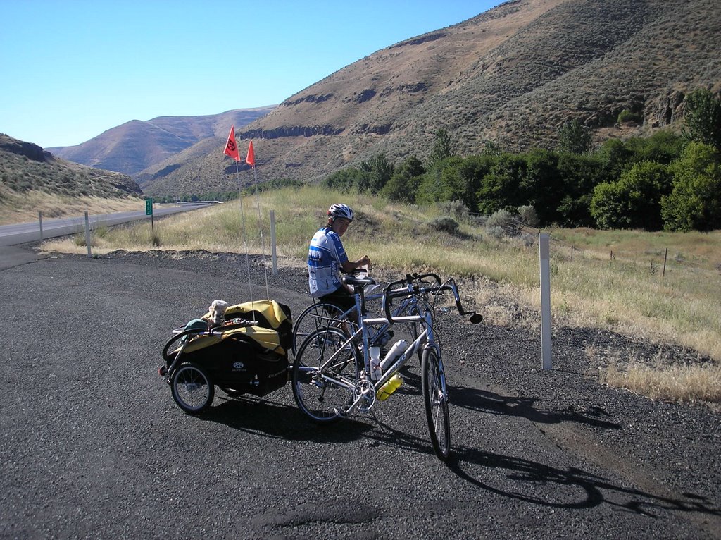
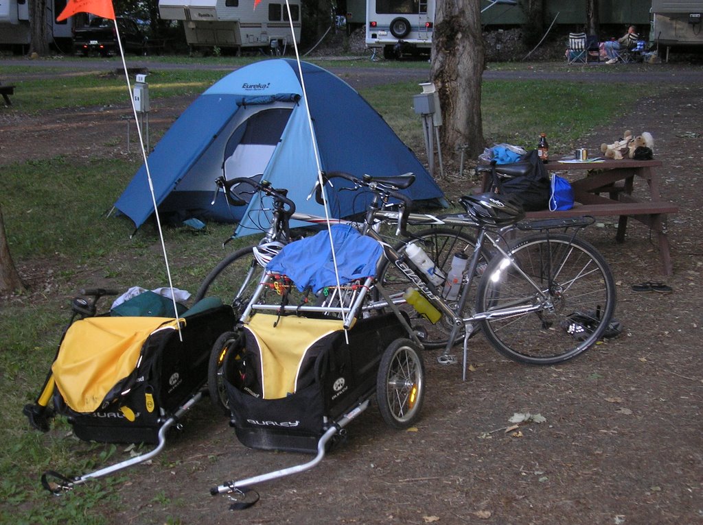
A 7:00 start even with breakfast, not too bad for us. We have a major climb today and we want to try to beat the wind. We expect to climb 2000 ft. today. We started the ride on a level lakeside road near Lower Granite Lake. We suspect that this is really part of the river we talked about yesterday. We had an 8 mile climb to the top of Alpowa Summit at 2785 ft. It took about 2 hours of climbing, but we had little difficulty, not even using our lowest set of gears (granny gears, we call them). We reached the summit at about 10:30 and prepared ourselves for an exhilarating ride down the other side. Alas, Mother Nature intervened by slapping us in the face with a sudden, fierce headwind. So what should have been a smooth, fast downhill turned into a grueling marathon. We pedaled our way downhill to Pomeroy, WA and had lunch at the Pioneer Eatery. During lunch, watching a locust tree across the road from the restaurant being whipped about by the wind, we decided to abandon our plan to ride another 40 miles to Lewis and Clark Trail State Park. Instead we called around and found an RV park about 26 miles away near a small crossroads called Delaney. It was 4 miles off route but looked like our only option. We arrived in several hours after fighting the in-your-face wind that never let up, but just got stronger. Tucannon River Retreat RV park is new and not well known (it wasn’t on our maps). We were the only campers, along with the camp hosts, the Hoovers, and another maintenance type fellow. We were pretty well dehydrated, so Mrs. Hoover kindly brought us a pitcher of ice-cold lemonade…we drank it all. This park is in a rural area which probably explains why, while we were eating supper, a wild turkey sauntered across the park, stopping to take a dust bath, then casually moved on. The wind was still blowing when we went to bed, not a good sign…wind at night generally means more wind during the next day. We have another major climb tomorrow that will be made doubly-hard by a headwind. We shall see.

-clarkwheel

Student question: The area we are traveling in (Pomeroy, Dayton, Walla Walla) is surrounded by this colorful Mountain range. What is the name of this range?

Sunday, July 16, 2006

Day 18-Winchester, ID to Clarkston, WA-46.42 miles

Our camp at Winchester Lake State Park atop Big Butte was at an elevation of about 4000 ft. Today when we arrived at our destination in Clarkston, we were at 850 ft., a net loss of 3150 ft. A good part of that loss was in an 8 mile stretch as we approached the town of Culdesac. It was a steep downhill with many hairpin turns on a road void of guardrails. We maintained a healthy 20-25 mph with the brakes on during most of the 20 minute ride down the butte. It was an exhilarating ride to swoop from banked curve to banked curve that left us breathless at the bottom. The ride from Culdesac on to Lewiston, except for one 800 ft. hill, was moderately downhill. This brought us to Hell's Gate State Park where we picked up a bicycle path that followed the river and then across the river(see the student question below) to Clarkston, WA. In Clarkston, while having a late lunch, we made arrangements at a Best Western for the night to update this neglected blog and to get some relief from the 103 degree temperatures. Now for the laundry...

-clarkwheel

Student question:
Hell's Gate State Park is located on the largest tributary of the Columbia River. (The Columbia was the river that carried Lewis and Clark to the Pacific). What is the name of this tributary?

Day 17-Kamiah, ID to Winchester, ID-46.75 miles


We left Kamiah and almost immediately were faced with a 2000 ft. increase in elevation in a 7 mile stretch of road. That translates to a mighty steep rise. The only upside is that the early morning hours were cool and calm. And that's not all. The remainder of the trip was also uphill but not as severe. This was a tiring day. What we actually climbed today was a huge butte called, appropriately, Big Butte. The terrain has changed dramatically. We are back in a agricultural region. The top of the butte, which must be hundreds of square miles, is hilly but flat enough to plant wheat, oats, and rye and pasture cattle.We concluded this exhausting day by stopping at Winchester Lake State Park and were dismayed when the car ahead of us got the last tent site. When we pulled up, the campground host said she had one site left in the RV section that we could have for the price of tent site. That means we would get electricity and water on the site, but not have to pay the extra fee. What a lucky break! It has been very dry lately with no rain in the forecast and pretty warm even at night, so we left the fly off the tent. I went to sleep tonight watching the stars in the Idaho sky.

-clarkwheel

Student question:
Winchester Lake State Park, in addition to renting camping sites, also rents yurts. From what continent does the yurt originate?

Day 16-Lowell, ID to Kamiah, ID-31.90 miles


Today was a somewhat of a dilemma. We either ride a rather short route or a very long route with a challenging uphill. We chose the short route followed by a moderate one for the challenging ride. As one can see, our mileage is not high today. We took our time enjoying another river (see the student question below for more information on the river) on our left the entire day. This river is much wider and tamer than yesterday’s Luchsa River. Occasionally we could see and hear whitewater but it was not a constant thing as yesterday. It still is mostly level or downhill for the entire 31 miles, so it was not a challenging day either. We stopped at Lewis-Clark Resort just outside Kamiah and across the road from a Nez Perce Historical Site. Earlier today we crossed into the Nez Perce Indian Reservation. This site depicted the legend of creation from the Nez Perce point of view. The historical site setting was quite fitting for the story and I enjoyed taking the tour.

The resorts in this area are quite complete. This particular one has a pool, hot tub, laundry, café, and even a fishing pond. Not that we could partake in all those amenities. We just enjoyed the pool, hot tub, and café.

When we came to our assigned site this afternoon, on our picnic table sat a baby bird. He was sitting straight up and not afraid of us at all. We sat at the table with it and took some pictures and he never moved. I couldn’t identify it but I could hear a vaguely familiar buzzing from the birds in the trees. Finally, I picked up the bird and started to move it to another table. Immediately the trees above me came to life with that buzzing and I recognized the parent birds as Cedar Waxwings. We have Cedar Waxwings in Indiana but they are not as commonly seen. Anyhow the baby flew away with a stuttering flight and we figured we had seen the last of it. Lo and behold, after supper, we came back to our tent and there he sat again on our picnic table. We watched him for a bit and then Tai picked him up (it just seemed to like to sit in Tai’s hands) and carried him to the next picnic table. Soon he flew, much more skillfully, into a nearby maple tree. The only reminder that he had been there was the deposit he left on the table. Of course, I found it by sticking my hand in it!

-clarkwheel

Student question: At Lowell, ID, we camped at the confluence of the Luchsa River and Selway River. These two come together to form the river we followed to Kamiah. What is the name of the river we followed today? Beware, it has a long name.

Day 15-Powell, ID (Lochsa Lodge) to Lowell, ID-66.21 miles


After breakfast at the Lochsa Lodge in Powell, we pushed off for Lowell. This trip promised to be downhill the entire way. The downhill wasn’t a coasting downhill. We had to pedal, but in most places it was pretty easy to go 14 or 15 mph. In fact, our overall average was 12.7, by far our best average so far this trip. The road was a curvy one; right and left…time after time…following the Lochsa River. The river was a rough, with a good deal of white water and it was always on our left. To the right, most of the way, were high cliffs with a brook every hundred feet or so rushing down the cliff, under the roadway, and into the Lochsa River. Add to that, the sheer beauty of being completely surrounded by mountains and one has the making for a very enjoyable ride. Even Captain Lewis mentioned the awe-inspiring beauty of seeing mountains in every direction, even though it was these very mountains that caused the expedition so much hardship. We went down as far as Wilderness Gate Campground, a National Forest campground about 26 miles short of Lowell and kicked around the idea of stopping there, but we decided to continue on to Lowell. The beauty and downhill ride continued on in to Lowell. We stopped first at the Wilderness Inn for a 3:00 p.m. lunch and then crossed the river to the Three Rivers Resort to spend the remainder of the afternoon and night. With a pool and hot tub just across from our tent, we didn’t have any problem using up the afternoon and evening hours. It was a delightful 66 mile ride and a relaxing afternoon.


-clarkwheel

Student question: The word Lochsa (in the Lochsa River) is a Nez Perce Native American word meaning what? Hint: It translates into 2 English words and I used them both in the narrative above.

Day 14-Lolo Hot Springs, MT to Powell Junction, ID-20.44 miles


Another pass done…today we scaled Lolo Pass, elevation 5255 ft. We left Lolo Hot Springs today at about 9:00 after a late breakfast at the local café. We meant to get an earlier start, however the café didn’t open until 8:00. This worked out well because when we woke up around 6:00, it was raining, so we got a little more sleep. From our campground, it was only 7 miles to the top of Lolo pass. We biked to within 4 miles of the pass, then the mountain stage really started. SpokeWrench scaled the mountain 12 min., 38 seconds ahead of ClarkWheel…a bit of time to pass. We went into the visitor’s center at the Montana-Idaho border; it was very interesting. Turns out that the visitor’s center was WiFi, so we took the opportunity to update the blogs, but we had connection problems. We were forced to hardwire through their router…this made the connection slow, so we didn’t update any pictures or send out the email. Descending Lolo pass was fun. We were told that westbound was the best way to go up the pass, as it was the more gradual route. Going down the west side, we were told, was very steep. That was correct, as we braked to stay under the speed limit. Maybe that is why the cars didn’t pass us. I looked in my mirror as cars approached us, then fell back as we surpassed their speed. Near the bottom, they finally caught up and passed, as the grade was getting less steep and we slowed down. Once we were done with most of the downhill, we approached the town of Powell, basically owned by one family. They own a gas station with prices 20 cents higher than most (not that that matters to us)…a small store…a great restaurant…as well as some cabins for rent. After inquiring about the price of a cabin, which seemed right to us, we rented one for the night. Short mileage is good somedays after a challenging ride.

-spokewrench

Student question: Today we passed through the DeVoto Memorial Cedar Grove , an stand of ancient cedar trees. Some of the trees have been growing for a thousand years before the birth of Christ. How can someone determine the age of a tree?

Wednesday, July 12, 2006

Day 13-Missoula, MT to Lolo Hot Springs, MT-40.17

We were on our bikes and moving by 8:10 this morning to beat the wind and heat. We feel we need to leave early because we are expecting to gain 1000 ft. in elevation in this 40 mile journey. The roads, 12 and 93, that we took from Missoula to Lolo was very busy reminding us of road 15 in Indiana. We lost route 93 at Lolo and the rest of the trip was very pleasant. It was one of the most beautiful rides of the trip so far. Even though it was uphill, it was a gentle grade with light winds and scenery was gorgeous.
A friend of mine described bicycle touring like this. If you encounter someone who says, "Are we there, yet?" A bicycle tourist can answer, "Yes, we are there...all the time!" The enjoyment is in the trip, not the destination." How true!
Lolo Hot Springs is a unique place. We checked in at the RV park in the village, set up our tent and went directly to the restaurant for a late lunch. After lunch we changed clothes and sampled the hot springs. The hot springs are made up of 2 pools, one is an indoor pool 104 degrees for soaking and the other is an outdoor pool at 85 degrees. It is particularly pleasant to soak in the hot one for as long as one can stand it and then go immediately to the cooler one. We enjoyed the hot springs for most of the afternoon and then took another evening dip before bed.

Student question: The Lolo hot spring water is a kind of mineral water of a varied composition. It is made up of:
30% Silicon Dioxide
29% Hydrocarbon
22% Sodium
8% Sulfur (one can smell this one)
3% Carbon Trioxide
3% Flourine
3% Cholorine
1% Calcium
1% Potassium
How many of these are elements on the Periodic Table and what are their abbreviations?

Day 12-Missoula, MT-Rest day-11.5 circular miles

We used today to get some needed things done. We mailed our army bags (used to carry the gear on the plane) to Dave, a friend we met on the trail last year who lives near Astoria, our destination. We took our bike to a repair shop for some brake and derailleur adjustment. We visited and toured the Adventure Cycling Headquarters. These folks are the creators of the maps we use. I have been a member of Adventure Cycling for 18 years. It was interesting to see their headquarters. We also stopped at REI and finally bought a pressure gauge to check tire pressure. This one works…third time is a charm.

This evening our neighbors from Alberta invited us to go with them to see Pirates of the Caribbean, Curse of the Dead Man’s Chest. We returned at bedtime…a very relaxing day.

Student question: Northeast of Missoula, on the return trip, Lewis explored the Marias river. During his exploration, a casualty resulted. Captain Lewis claimed a Native American was trying to steal something, but the Native Americans claimed he was trying to steal something of theirs. A Native American died because of this. What was each claiming the other was trying to steal?

Day 11- Lubrecht Forest to Missoula, MT- 35.15 miles

Ever since we left Great Falls, we have technically left the westbound Lewis and Clark Trail. Lewis and Clark actually followed the Missouri River out of Great Falls in a southwesterly direction towards the present-day city of Butte and then came back north to Missoula. On the eastbound trip, they split up with Clark again going down toward where Butte is now and Lewis took the route on which we are currently going west. In other words, we are on the trail but it is actually Lewis’s return trail. We will join with the westbound Lewis and Clark Expedition once again in Missoula.

We left Lubrecht’s and had a relatively comfortable downhill ride to Missoula. We dropped nearly 1000 ft. during the 35 mile ride. We continued on through Missoula, taking advantage of the many bike lanes that are scattered throughout the city. Traffic is very heavy even on Sunday, but the bike lanes make getting around fairly simple. One thing we haven’t figured out is how to make a left turn across 2 moving lanes of traffic from the bike lane. If anyone knows, please email. We have resorted to pulling off at the left turn intersection, pushing the crossing button, and walking our bikes to the opposite side of the road and then repeating that again…pretty time consuming. We are camping a the Missoula KOA. It’s like its own village with all kinds of services and things to do. One of those is the laundry that desperately needs done. Everything we have is dirty. We even found that most of the time we can get a wireless connection from our own picnic table. We have very interesting, friendly neighbors; Mike, Lois, Jessica, and Brent from Fort McMurray, Alberta. We visited with them until midnight, knowing that we are planning on spending another day here.

Student question: We followed a river pretty much all the way from Roger’s Pass. The river’s name is shared with a Native American tribe name. What is the name of the river?

Day 10- Lincoln, MT to Lubrecht Experimental Forest - 50.49 miles

Brrrrr….when we crawled out of the sleeping bags at 6:30, we noticed quite a difference in the temperature from yesterday’s 90 something degrees. I inquired at Ponde-rosa’s Restaurant where we had breakfast and was told that it had gotten down to 34 degrees last night.

“Not unusual,” the gentleman sitting next to us said. “Last week it got down to 28 degrees. Welcome to the mountains!”

We did have a great night’s sleep with the brook gurgling by. We headed on to a campground called Lubrecht. We were advised at the restaurant that this was a big fishing week and many campgrounds could be full. In light of that, I tried to call and reserve a spot at Lubrecht’s but no cell service so we’ll just have to take our chances. We were also told that just outside of Lincoln was one of the largest jerky manufacturing plants and there was a trading post attached. It was an interesting place to visit. We stopped there, and found that to be true. We stocked up on jerky, a good riding snack and bought Tai a sweatshirt in case of more cool weather.

Today, we again had some headwind but it was tolerable and we made reasonable time. We stopped for lunch at Trixie’s Café and Bar in Ovando, about half way along on the ride. The scenery is beautiful here in the mountains, but, of course we are going up and down constantly.

We arrived a Lubrecht’s only to find it almost deserted except for a large group of campers who called themselves the Barons of “something” Keep. This is a group who practice medieval martial arts. They were having some sort of rally that evening at this campground. We inquired as to who to secure a campsite but no one really knew. I called the number from a phone in the camp but just an answering machine. We were just about to become squatters, when a lady pulled up in a truck. She was a caretaker of the campground and took our $5.00 and gave us permission to camp. There are flush toilets and hot showers, but no electricity. It is situated in the middle of pine forest and she just said find a spot to set up your tent anywhere you want. We talked to the “Barons” and they all warned us that they planned a big campfire that night and it might be loud and boisterous at times. We decided that we were probably tired enough to weather almost anything. We set up camp a little away from their planned bonfire. They were correct and so were we. They were loud but their loudness was overcome by our tiredness and it all worked out.

Student question: The past 3 nights have been very clear. I have noticed that I can see roughly twice as many stars out here than I can back in Indiana. What are 2 reasons why this is true?

Sunday, July 09, 2006

Day 9-Bowman Campground to Lincoln, MT-40.18 miles

Roger's Pass--This is the day we have been talking about since last year's trip. This is the highest pass we will encounter on the entire trip through the mountains. We awakened to a strong 20-25 mph headwind. It was strong enough that I had decided to stay at this campground another night. It was primitive but the owner was a very friendly person and that can make all the difference. At about 9:30 a.m. we noticed the wind was somewhat calmer. We decided to go for it. No sooner had we started than the wind picked right back up and even got stronger. It remained very strong throughout the day. For me, it was one of the 3 most difficult biking days I have every done. It ranked right up beside Fort Peck to Jordan, MT last year...a 100 mile marathon that we didn't finish until way after dark and the other was Durango to Silverton, CO, a 50 mile, 3000 ft. gain in elevation that I had done when I was in my thirties. Had it not been for the wind, this would not have been so challenging, but the wind never faltered. We even had to pedal (not coast) down the other side after cresting the 5610 ft. pass. It sure took the fun out of the downhill! We finished at about 6:00 p.m., arriving at Lincoln, MT. We stopped at Shake and Burger, the first place we came to and had something to eat. There had been no other place to eat during the entire ride. Our campground it great! Electricity, water, flush toilets, and a hot shower. Our campsite is only 3 ft. from a gurgling brook. What a great night's sleep!

Student question: As you have read and can see, we rode over the highest elevation of the trip and over the continental divide. Describe a continental divide.

Day 8-Simms, MT to Bowman Campground-40.73 miles

The best part about today was that we biked parallel to the front range of the Rocky Mountains. It was hilly...it was headwindy but it was beautiful to us flatlanders. We rode 22 miles to the town of Augusta and had lunch there. While there we inquired about a library and found there was one and it had free internet service. We took advantage of it and uploaded the previous 3 blogs. That started us out late for Bowman Campground but we needed the rest time anyway. The wind had tired us out. The last 18 miles became very hilly so we were slowed down even more. Finally we arrived at Bowman Campground...unless you had an RV, the amenities for this campground were minimal. We had a spot next to a cattle pasture and we had water. The restroom was a portable jon that apparently hadn't been used in some time. There was a restaurant, so we took the opportunity to charge our cell phones while we ate...not that it did us much good...we didn't have service once we had a charge. A storm blew in during the evening and changed the wind direction. I was hoping that it would bring us a more favorable wind for tomorrow's biking. Early to bed.

Student question: The route we are taking from Great Falls to Missoula on Road 200 is actually much closer to the route Lewis took on the return trip from the Pacific in what year?

Thursday, July 06, 2006

Day 7-Great Falls to Simms-33.94 miles

We purposely chose a shorter route today, although there wasn't much choice. Because of the locations of the campgrounds, we either had a short day or a very long one. Since neither of us are feeling 100%, we opted for the shorter route. The road was fairly flat with a quartering tailwind, so it wasn't too taxing. We stopped in Fort Shaw for lunch. We then biked the remaining 11 miles to Simms. Our maps told us that Simms had a campground. When we arrived, we found that the campground was really a service area with a few gravelly spots for RVs to park. There were no restrooms, except in the campstore and no showers. We had little choice at this point, so we spent the night here and made do with what we had. Sort of survival camping...

-clarkwheel

Student question: We have been following a river today that the Native Americans called the Medicine River. What is the present-day name of this river?

Day 6-10.6 circular miles in Great Falls, MT

Tai is still not up to par, but his fever is down and he is just tired. I kept Tai in bed as much as possible today, but in the afternoon a flat tire on my bike forced me to get him up. In the afternoon, I had biked the 5 mile trip to the Lewis and Clark Interpretive Center in Great Falls. It was a very complete center, one of the best I have seen. It included a video and lecture by one of the National Park people, plus it had a large display that centered around the portage of the Great Falls of the Missouri. When I finished and went to my bike, I found I had a flat tire. I did not bring my tool kit or new tubes, so my only alternative was to call Tai and have him bring out what I needed. I hated to disturb his rest day, but there was no other alternative. He brought everything out and we fixed the tire and returned to the hotel. We are looking forward to biking tomorrow.

-clarkwheel

Student Question- About how long were Lewis and Clark in the Great Falls area portaging and doing other chores?

Day 5-Great Falls, MT-Rest day-16.07 miles (Circular miles without the trailer)

We took a rest day…not really by choice. Spokewrench was running a low grade fever last night and this morning. He was pretty tired today, so we decided to stay at the hotel another day…even though we can’t get the wireless to work. To be honest, I am not really feeling quite up to par myself. The sore throat has turned into a nose issue and I am a little tired, too.
Well, laundry is done, groceries are purchased, and we have visited the bike shop to take care of the cadence and air pump problems. We have visited the hot tub and the pool several times as a bonus. Actually it was a blessing in disguise as it started raining just a little afternoon and it is still raining at 4:00 p.m., a miserable biking day. I would still like to take a tour around town, though, to look at the falls and a museum or two, but I prefer not to do that in the rain.
The hotel has been a minor disappointment. There has been no connection at the hotel for the past 2 days. It will probably be necessary to update by going to be an internet café down the street from the hotel.
It finally stopped raining around 4:30 so we took off to do some sightseeing. Obviously, this is where Lewis and Clark found the Great Falls of the Missouri. We biked to 2 of the 5 falls they found. These falls have been pretty much tamed as you can see by the pictures. Lewis and Clark recorded that they could see the mist from the falls quite a distance before actually seeing it (see the student question below). As you can see from the pictures, the falls are not big enough now to produce much mist at all. What we did find besides the falls was the River’s Edge Trail; a beautiful 2 lane paved bicycle and hiking trail. We rode about 10 or 12 miles of the trail.

-clarkwheel

Student question: Lewis and Clark could see the mist from the falls about how many miles away before they actually laid eyes on it?

Day 4-Fort Benton, MT to Great Falls, MT-42.48 miles

I got up at 5:30. We decided that, if possible, we will be on the road early. We have noticed that if it is going to become windy, it usually starts up after 9:30. Also, the heat is at its peak around 2:00 or 3:00 p.m. It’s good if we can avoid that. The problem is, no matter how early we crawl into our sleeping bags, it is still extremely difficult to leave them in the mornings. Today, we started pretty early…for us. We were on the road before 7:30. We started out with a pretty good uphill, but then it flattened out and was mostly a rolling landscape today. At about the 25 mile mark, we stopped for a water break and were attacked by hordes of mosquitoes. They were unbearable! Our insect repellent was buried deep in the trailer because we have never needed it during the ride itself. To stop and dig it out with those bugs was not an option. We took off immediately, but the mosquitoes followed. Unfortunately, we were climbing a hill and they were keeping up with us. We were forced to increase our pace and to just keep pedaling for those last 15 miles or so. We were really tired coming into Great Falls.
This story has a happy ending. We had reservations at the Comfort Inn for tonight. I can’t describe how good a hot tub feels after a day of biking! Tonight was no exception.

By the way, we think we spotted a coyote today. We had stopped for some water and Spokewrench saw it moving across the field.

Student question: When Lewis and Clark arrived at the falls, they found it necessary to portage around the falls. How many miles did they have to portage to get around the falls?

-Clarkwheel

Saturday, July 01, 2006

Day 3-Geraldine to Fort Benton-31.33 miles

It’s a hot day in Montana, close to 90 degrees but I am sitting under a cluster of quaking aspen with a breeze that is making the heat quite bearable…one might even say pleasant. Yet a couple of hours ago as we were biking into Fort Benton, that very same breeze was making our ride torturous. It was a short ride today. We got caught by the wind yesterday which was substantially stronger. We stopped at Geraldine mostly because of the strong winds. Today was the about the same situation. We had a choice of going to Fort Benton just 27 miles or so or going on to Great Falls about 68 miles. The wind gave us the answer, loud and clear. It took us over 3 hours to fight the wind for the 26 miles and it pretty well exhausted us. There is nothing between Fort Benton and Great Falls, so Fort Benton seemed the obvious choice. Anyhow I wanted to look around a bit in Fort Benton. It is the site that originally piqued my interest in the Lewis and Clark Expedition. This occurred when I was a fifth grader. There was a story in the fifth grade reader called “Which is the Missouri It told about how the Corps came to a fork in the Missouri River. One fork went northerly and the other more in a southerly direction. Both Lewis and Clark felt the south fork was correct but the men thought the north fork was the one to follow. They only thing they knew from the Native Americans was that the real Missouri had a huge set of falls further up the river. The story tells about how they explored a short way up both forks but no falls. Finally Lewis and Clark proposed to explore further down and the south fork with part of the provisions until they found (or didn’t find) the falls. As we know, after several days of exploring, they did find the falls of the Missouri (now the present day site of, appropriately, Great Falls, MT). We basically had the afternoon to explore so we found 2 museums. Both were very well done, especially the second one. It was a sort of a history of this town with many, many artifacts and much information. We spent a couple of hours exploring these museums.

Student question: I just told the story of the fork in the Missouri River. Since the south fork was the actual Missouri, what is the present day name of the other river, the north fork?

stats coming soon

Day 2-Denton, MT to Geraldine, MT -37.70 miles


We got a fairly early start from the city park at Denton and stopped at the Denton Café for a couple of orders of biscuits and gravy. We headed out to fairly flat terrain and calm winds. We made good time in the early going.

Yesterday, soon after we started out, I could see in the far distance a mountainous-type landform. It was barely visible through the haze. Now we are at the foot of the landform. In fact we bicycled around it today. It is quite prominent and dominates the landscape. We have posted a picture of it on along with this narrative. Students, it is related to your question for today.

At around noon we stopped at a small village of 25 people called Square _______. We had lunch at the Square ______ Bar and Café. While we were eating a cold front moved through the area and did cool things off a bit, but more significantly it brought in a blast of strong northwest winds. We had intended to go on to Fort Benton today and Great Falls tomorrow, but after battling the northwest headwind for 1½ hours we decided to call it quits and stop at the small town of Geraldine. We inquired about camping and found that again the city park was available. So for the second day in a row, we camped showerless and powerless. Both our cell phones are dead as well as our two-way radios and the computer only has a few minutes left on it. We had supper tonight at Rusty’s Bar and Grill and asked if we could charge our cell phones while we were eating. The waitress was very obliging and even offered to keep them charging. We could come back later in the evening and pick them up. So by bedtime, we did have some cell phone power…but, alas, now there is no signal…Oh well, such is biking in Montana.

Student question: I have already alluded to the question. What is the name of the type of landform you can see in the picture. The name of this landform will also fit in the blanks above. Good luck and remember to email your answers to


stats coming soon